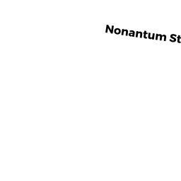
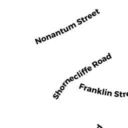
111 NONANTUM ST
Owner Information
PETRIN RENE
111 NONANTUM ST
BRIGHTON, MA 02135


Property Details
111 NONANTUM ST is classified as a Single Family Residential (Colonial).
The primary structure on this property was built in 1885. There is 1,546ft2 of residential/living space within this property. This property is listed as having 7 rooms.
111 NONANTUM ST is valued at $625,200. The land is valued at $243,600 and the structures are valued at $381,600.
The most recent deed for 111 NONANTUM ST is recorded at the local registrar in Book 28695, Page 182. 111 NONANTUM ST was last sold on Friday, June 7, 2002 for $395,000.
Assessment data from fiscal year 2020.
Flood Data
According to the FEMA National Flood Hazard Layer, this property does not appear to be in a flood zone. It may also be in an area not yet reviewed. Nonetheless, confirm this information prior to taking any action.
To view the flood hazards around this property, create a FEMA "Firmette" Map of the area around 111 NONANTUM ST.
Broadband Internet Providers
| Provider | Type | Bandwidth (mbps) | |
|---|---|---|---|
| Verizon New England Inc. | DSL | 15 | 1 |
| VSAT Systems, LLC. | Satellite | 2 | 1 |
| HughesNet | Satellite | 25 | 3 |
| GCI Communication Corp. | Satellite | 0 | 0 |
| T-Mobile | Fixed Wireless | 25 | 3 |
| RCN | Cable | 1000 | 20 |
| RCN | Cable | 500 | 20 |
| Comcast | Cable | 1000 | 35 |
| Verizon New England Inc. | Fiber | 940 | 880 |
| Viasat Inc | Satellite | 100 | 3 |
Broadband service provider data from December 2020.
Adjacent Properties
- 117 NONANTUM ST
Two-Family Residential owned by PARARAS JAN F TS - 100 Tremont ST
Apartments with More than Eight Units owned by DEE DEVELOPMENT LLC - 2-10 TREMONT PL 2
Residential Condominium owned by CHENG YUN - 2-10 TREMONT PL 4
Residential Condominium owned by DELUCA PETER M - 2-10 TREMONT PL 6
Residential Condominium owned by AAM LLC - 2-10 TREMONT PL 10
Residential Condominium owned by BUCKLEY RUTH - 2-10 TREMONT PL
Other, Open Space owned by TWO -10 TREMONT PL CONDO TR - 2-10 TREMONT PL 8
Residential Condominium owned by PUTNAM SCOTT - 109 NONANTUM ST
Single Family Residential owned by YUEN PUI LAM